Telecom

Optimize your network planning, site selection, and asset management for your telecom business. Analyze market trends and customer behavior with ease.

In the telecom industry, location intelligence powers connectivity. At Jugrafiya, we deliver geospatial solutions that help telecom companies plan, optimize, and monitor their networks with precision. From fiber rollout and 5G planning to tower management and customer coverage analysis, our solutions bridge the gap between infrastructure and intelligent decision-making.


What We Do

We partner with telecom operators, infrastructure providers, and government bodies to:

  • Plan and optimize telecom networks (fiber, cellular, and 5G)

  • Analyze coverage areas, signal strength, and gaps

  • Map and manage towers, poles, and underground cable routes

  • Build real-time dashboards for network performance and outage tracking

  • Integrate telecom GIS data with OSS/BSS systems, CRM, and ERP

  • Enable customer-facing coverage maps and service availability portals


Technologies We Use

We use a combination of open-source GIS platforms and modern mapping technologies to create scalable and high-performance telecom solutions:

Mapping & Visualization

  • Mapbox GL JS / MapLibre

    For responsive coverage maps and network visualization with modern, high-quality cartography.

  • Leaflet.js

    Lightweight interactive maps for internal and public-facing portals.

  • OpenLayers

    Advanced visualization for multi-layer network data and complex projections.

Backend & Data Services

  • GeoServer

    For serving network layers, fiber routes, and tower locations through WMS/WFS standards.

  • PostgreSQL + PostGIS

    High-performance spatial databases for storing and analyzing telecom assets, coverage zones, and service areas.

  • QGIS

    For planning, route design, and custom map production for internal use.

  • Python (Django / Flask / FastAPI)

    APIs for data integration (OSS, BSS) and real-time availability checks.

  • Turf.js

    Client-side geospatial calculations (e.g., coverage radius, signal overlap).


🔍 Telecom GIS Solutions

  • Tower & Asset Management

    Manage telecom towers, poles, and antenna infrastructure with detailed asset data and maintenance records.

  • Coverage & Signal Analysis

    Visualize 2G, 3G, 4G, and 5G coverage areas and identify coverage gaps or overlapping zones.

  • Fiber Network Planning

    Plan and monitor fiber routes, underground cable layouts, and right-of-way management.

  • Outage Monitoring & Response Dashboards

    Real-time outage maps with crew dispatch tracking and restoration timelines.

  • Customer Availability Portals

    Public-facing maps for service availability, enabling customers to check coverage or plan connections.

  • Route Optimization for Field Teams

    Efficient routing for tower inspections, maintenance teams, and cable laying.


Why Jugrafiya?

  • Deep understanding of telecom network planning and GIS integration

  • Expertise in both open-source and enterprise solutions for flexibility and cost efficiency

  • Experience creating real-time coverage dashboards and customer portals

  • Agile, customized development for your unique network data and workflows


Let’s Build Connected Maps

From planning fiber rollouts to visualizing 5G networks, Jugrafiya helps telecom providers deliver smarter, faster, and more reliable connectivity using powerful geospatial tools.

Related Projects

ORBIT3LABS

This WebGIS app was developed for Orbit3Labs that brings you real-time insights into Surface Urban Heat Island (SUHI) values for major cities worldwide. With an

GoDevelApp

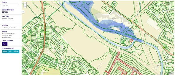
GoDevelApp is a powerful tool for development appraisal and property sourcing. It offers essential information, options, and solutions for proposed projects, taking into account council

Get in Touch with Us

Have a question, project idea, or need support? We’re here to help. Reach out to our team, and we’ll get back to you as soon as possible.