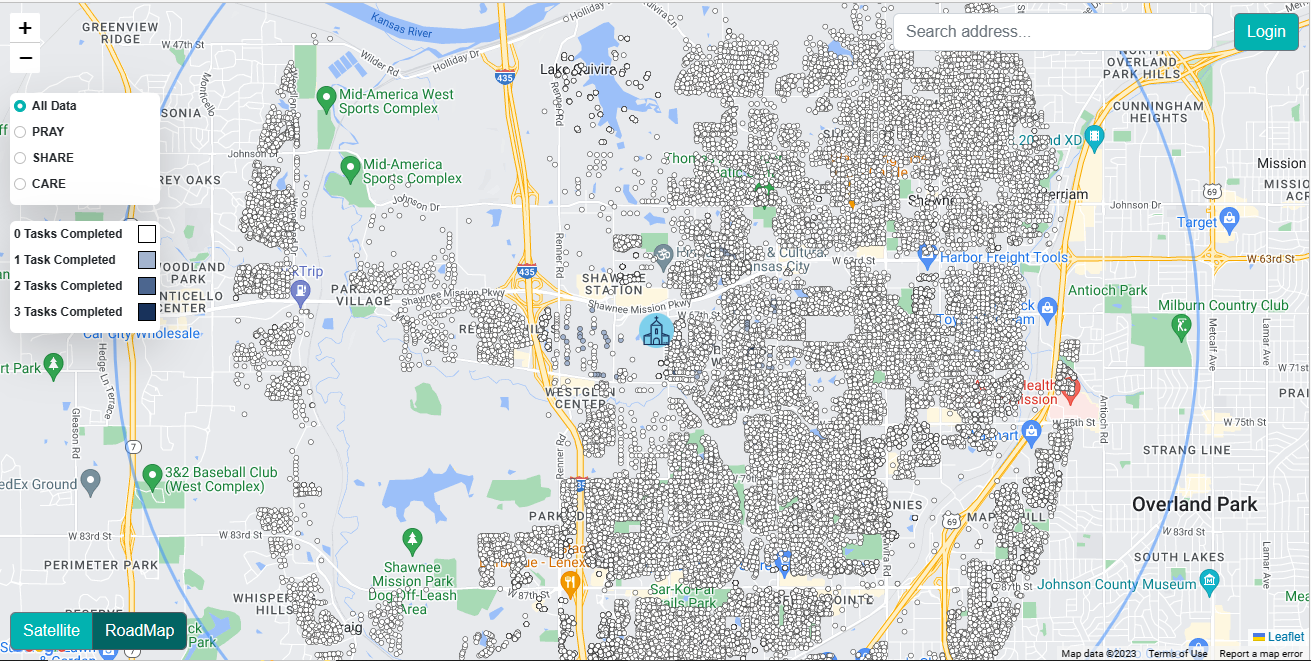
CrosspointsChurch
Cross Points Church, located in Kansas City, has created an innovative platform designed to streamline and facilitate various church tasks for the local community. This
Visualize and analyze property data, make informed decisions on property development, site selection, and market analysis.
In real estate, location is everything — but understanding location requires more than just a map. At Jugrafiya, we help real estate developers, investors, and planners turn geospatial data into actionable insight using powerful open-source mapping technologies.
Whether you’re planning a new residential community, managing a growing property portfolio, or building a digital map portal for your customers — we provide scalable, flexible, and cost-effective GIS solutions to bring your vision to life.
We support real estate teams with:
Custom real estate mapping portals for plot sales, listings, and customer interaction
Interactive master plan visualizations with zoning overlays, infrastructure, and plot boundaries
Site suitability analysis using environmental, demographic, and accessibility factors
Location-based analytics for market potential, urban expansion, and investment risk
Integration with existing ERP, CRM, or property management systems
We specialize in leveraging open-source GIS tools and libraries that offer high performance, flexibility, and cost savings:
Mapbox GL JS / MapLibre
For fast, responsive, and beautifully styled interactive maps.
Leaflet.js
Lightweight, flexible web maps with custom controls and plugins for real estate applications.
OpenLayers
Advanced spatial visualization where vector-tile precision or custom projections are required.
GeoServer
Publish and manage spatial data using open standards (WMS, WFS, WMTS) — ideal for property boundaries, zoning, utilities, and more.
PostgreSQL + PostGIS
The backbone of our geospatial data architecture — fast spatial queries, area calculations, spatial joins, and indexing for large-scale property datasets.
QGIS
For offline analysis, planning support, and field-ready GIS outputs.
Turf.js & PyProj
Perform client-side and backend geospatial calculations — distances, buffers, intersections, etc.
Python (Django / Flask / FastAPI)
For building scalable APIs that support land parcel lookup, availability status, and analytics.
Plot Sales Portals
Interactive web maps for customers to explore plot boundaries, sizes, prices, and nearby facilities — with real-time availability.
Master Plan Viewer
Zoomable digital versions of master plans showing roads, utilities, green areas, and development phases.
Zoning and Regulatory Layers
Overlay land use policies, environmental constraints, and legal parcels for better planning and approvals.
Investment Suitability Dashboards
Visual tools to identify high-potential plots using population growth, proximity to roads, schools, utilities, etc.
Land Portfolio Management
Internal dashboards to track owned plots, lease status, valuation, and development timelines.
Deep expertise in open-source GIS stacks
Proven track record of delivering cost-effective custom portals and dashboards
Experience handling high-volume land parcel data
Agile team that adapts to your local context, branding, and workflows
No vendor lock-in — full control over your mapping infrastructure
Whether you’re building cities, selling plots, or managing hundreds of assets — Jugrafiya provides the tools to see smarter, build better, and sell faster.
Cross Points Church, located in Kansas City, has created an innovative platform designed to streamline and facilitate various church tasks for the local community. This
Have a question, project idea, or need support? We’re here to help. Reach out to our team, and we’ll get back to you as soon as possible.