Adventure Guru
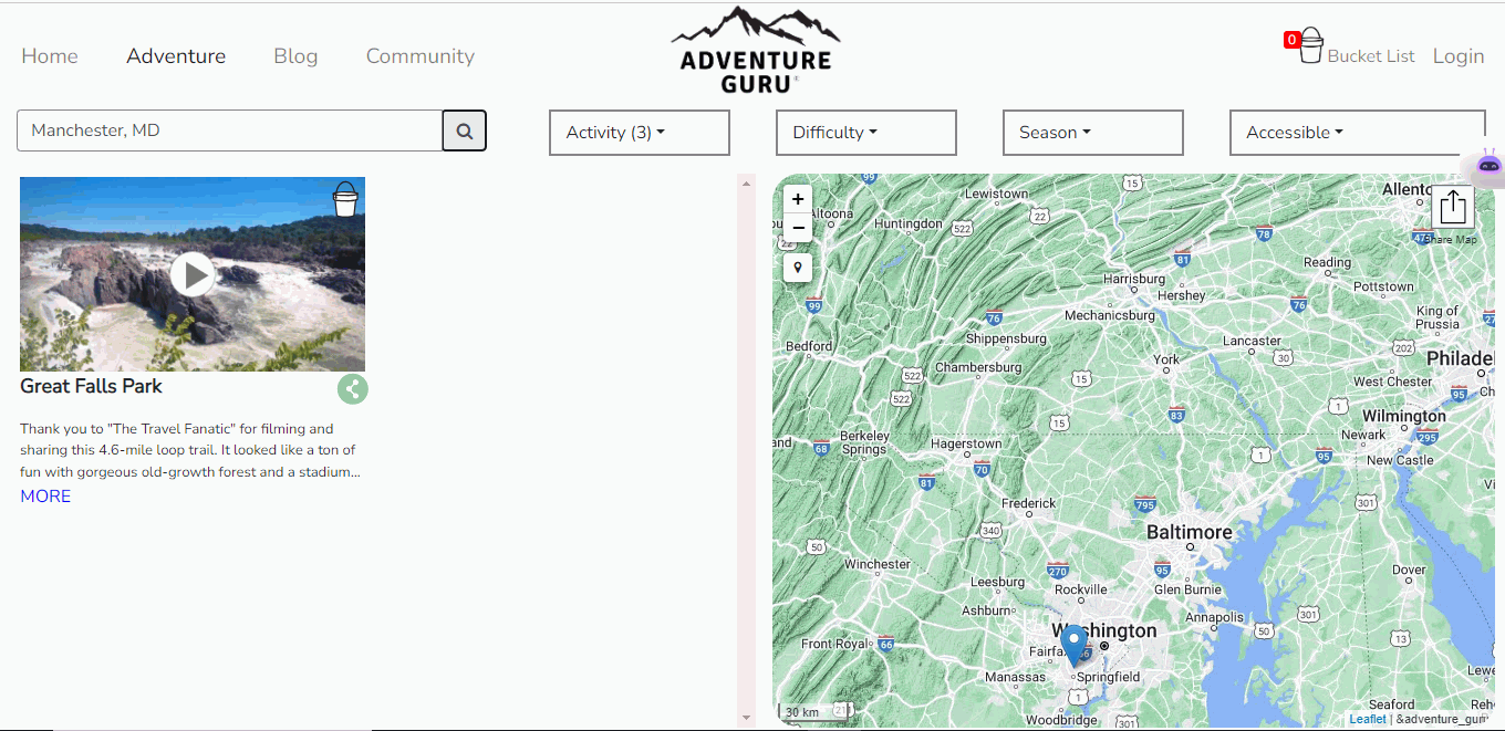
Adventure Guru is a inclusive video-based adventure guide that aims to address the diversity problem in outdoor recreation. Unlike other outlets that cater to a
Track assets, assess risks, manage pipelines and visualize data to optimize your operations.
The Oil & Gas industry demands precision, security, and agility across vast and complex geographies. At Jugrafiya, we bring deep geospatial expertise and field-tested experience to help energy companies navigate these challenges and unlock actionable insights across the entire hydrocarbon lifecycle — from exploration to distribution.
Backed by project experience with global leaders like Saudi Aramco and British Petroleum, and proven capabilities in both Upstream and Downstream operations, our solutions blend domain understanding with powerful GIS-driven intelligence.
We empower Oil & Gas companies to:
Map, monitor, and manage pipeline infrastructure, wells, facilities, and field assets
Build interactive dashboards and spatial analytics for operational visibility and decision support
Digitize and automate field inspections, incident reporting, and asset integrity workflows
Enable real-time spatial decision-making across all business units — from drilling to refining
ArcGIS Enterprise & ArcGIS Pro
End-to-end GIS solutions from field to office, with secure data governance and advanced geoprocessing tools.
ArcGIS Utility Network (Oil & Gas Data Model)
Represent gathering, transmission, and distribution networks with detailed connectivity, traceability, and topology validation.
ArcGIS Experience Builder & Web AppBuilder
Create mission-critical applications for field crews, supervisors, and executives — accessible across web and mobile.
ArcGIS Field Maps, Survey123, and QuickCapture
Mobile-first field data collection and asset verification for pipeline inspections, cathodic protection, and spill monitoring.
ArcGIS Dashboards
Real-time visual command centers for leak detection, well performance, and contractor activity.
Python / ArcPy
Custom geoprocessing tools, automation scripts, and data validation for engineering workflows.
PostGIS / SQL Server (SDE)
Enterprise-grade spatial databases integrated with internal IT and business systems.
FME (Feature Manipulation Engine)
Seamless ETL across CAD, shapefiles, spreadsheets, and SCADA feeds.
REST APIs / GeoEvent Server
Stream live telemetry, sensor data, and incident alerts into your GIS dashboards.
AutoCAD & BIM-GIS Integration
Enable design-to-field continuity and asset lifecycle tracking from engineering models to operational maps.
Firsthand experience with Oil & Gas GIS environments and enterprise-scale datasets
ArcGIS Certified developers and consultants
Agile delivery for custom apps, data models, and workflows
Informed by real-world operational needs, not just technical specs
Deep integration knowledge with SCADA, EHS, and Asset Management Systems
Whether you’re mapping upstream potential or optimizing downstream operations, Jugrafiya delivers the geospatial edge your energy projects need.
Adventure Guru is a inclusive video-based adventure guide that aims to address the diversity problem in outdoor recreation. Unlike other outlets that cater to a
Have a question, project idea, or need support? We’re here to help. Reach out to our team, and we’ll get back to you as soon as possible.